VT-Haiti-Maps
Jump to navigation
Jump to search
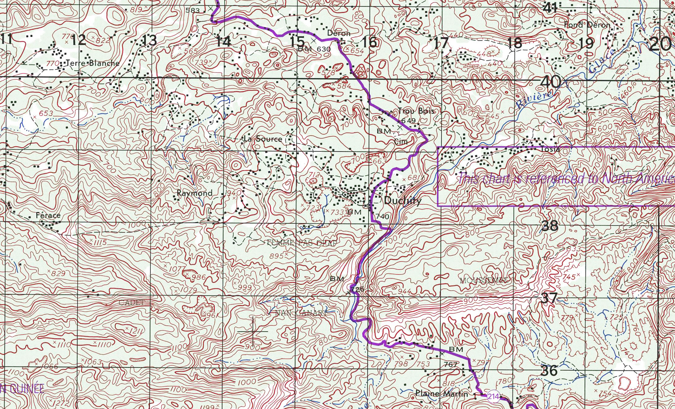
DuchityTopoMapCloseUp (Right-click and open in new tab) (Also shown below)
DuchityAreaTopoMap (Right-click and open in new tab)
beaumont-haiti-tlm50-54713.pdf (Click to download / display .. depending on your browser) This is the entire Topo quadrangle of the area from Camp Perrin up.
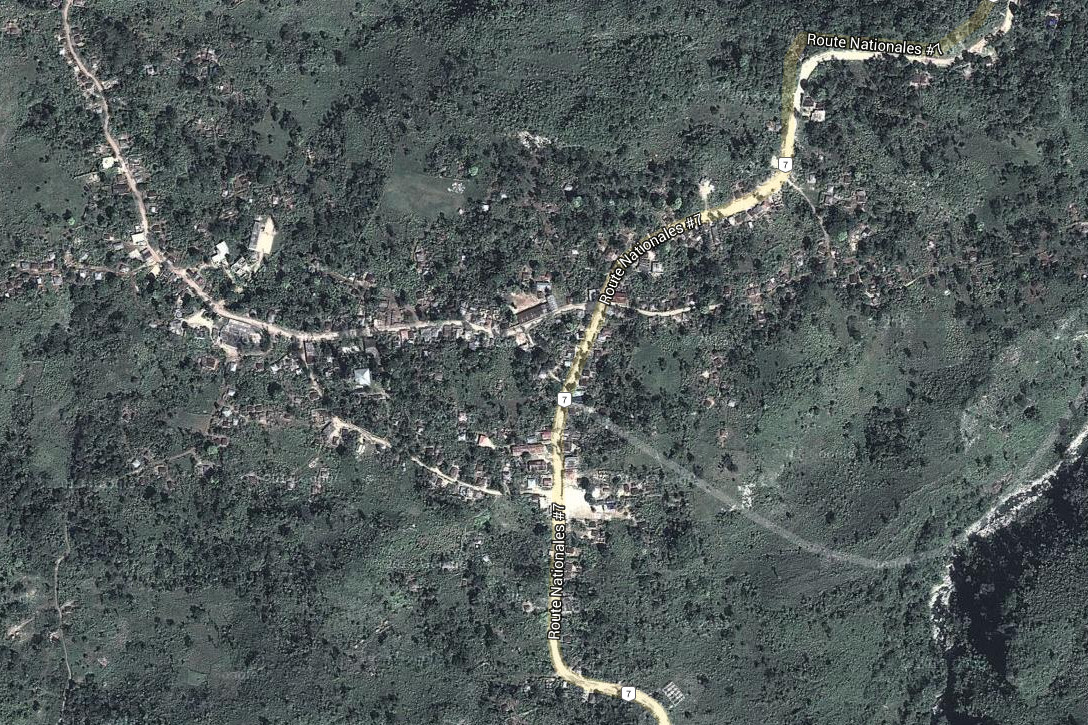
DuchitySatellite-01.jpg (Right-click and open in new tab) (Satellite map from Google, Maps) (Also shown below)
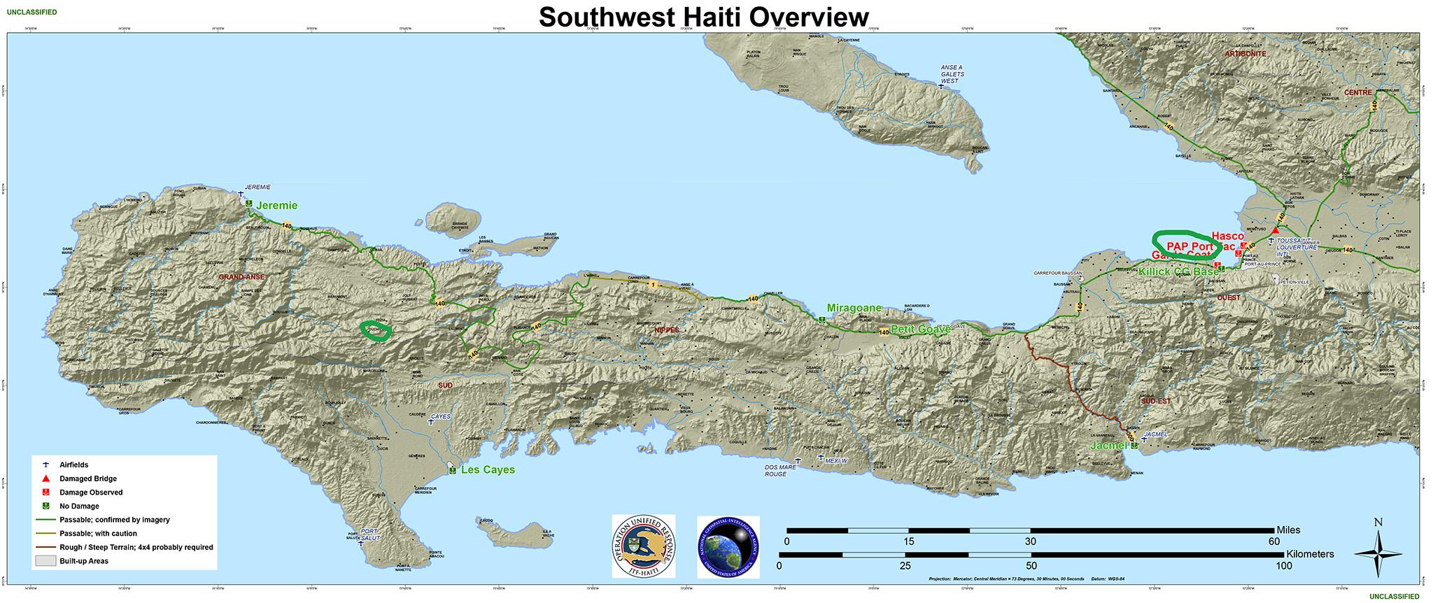
SouthWest Haiti Peninsula from Port A Prince to the end. (Click to download / display .. depending on your browser)
NOTES: These Topographic Maps (WikiPedia) show the terrain, elevations, land cover type, buildings and roads/trails, rivers and streams etc.
Each of the squares is 1 Kilometer (3280 Ft)
Ayiti Èd-MAPS
(Back to main page)
print this page
original name: Duchity
geographical location: Grand Anse, Haiti, Central America
geographical coordinates:
18° 26' 0" North, 73° 54' 0" West
18.435038 N -73.901006 E Lat-Long
616377.58 2038572.12 UTM
OpenStreetMap - Duchity Area
Topographic Maps - Show terrain, elevations, high detail
DuchityTopoMapCloseUp (Right-click and open in new tab) (Also shown below)
DuchityAreaTopoMap (Right-click and open in new tab)
beaumont-haiti-tlm50-54713.pdf (Click to download / display .. depending on your browser) This is the entire Topo quadrangle of the area from Camp Perrin up.
DuchitySatellite-01.jpg (Right-click and open in new tab) (Satellite map from Google, Maps) (Also shown below)
SouthWest Haiti Peninsula from Port A Prince to the end. (Click to download / display .. depending on your browser)
NOTES: These Topographic Maps (WikiPedia) show the terrain, elevations, land cover type, buildings and roads/trails, rivers and streams etc.
Each of the squares is 1 Kilometer (3280 Ft)


[/file/view/southwest_haiti_overview.pdf/572275665/southwest_haiti_overview.pdf southwest_haiti_overview.pdf]
[/file/view/southwest_haiti_overview.pdf/572275665/southwest_haiti_overview.pdf southwest_haiti_overview.pdf]
- [/file/detail/southwest_haiti_overview.pdf Details]
- [/file/view/southwest_haiti_overview.pdf/572275665/southwest_haiti_overview.pdf Download]
- 3 MB
Other Information / Places
The Ice River Ford now replaced by good bridge. Previous Tragedy HERE

About Saut Mathurine
- Type: Waterfall
- Location: Haiti, Caribbean, North America
- Latitude: 18° 26' (18.4333°) north
- Longitude: 73° 49' (73.8167°) west
zz